Places To Visit In Kinnaur - Himachal Tourist Places - Himachal Tourism :: Himachal Guide
Kinnaur is one in all twelve districts within the Indian state of Himachal Pradesh, India.The district is divided into 3 management areas – Pooh, Kalpa, and Nichar – and has 5 tehsils. the executive headquarters of Kinnaur district is at Reckong Peo. Kinnaur is located in the northeast corner of Himachal Pradesh border. It has three high mountains ranges, namely, Zanskar, Himalayas and Dhauldhar that enclose valleys of Sutlej, Spiti, Baspa and their tributaries.
Kinnaur is one of the smallest districts in India by population. It is famous for the Kinnaur Kailash, a mountain sacred to Hindus, close to the Tibetan border.
 |
Famous Places :
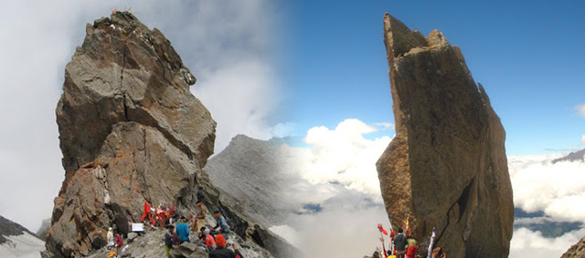
Kinnaur Kailash : The Kinnaur Kailash is a mountain in the Kinnaur district of the Indian state Himachal Pradesh. The Kinner Kailash Parikrama Trek is a journey which must be undertaken at least once in a lifetime. One can undertake this holy parikrama from Morang and return to Kalpa / Karcham in 7- 8 days.
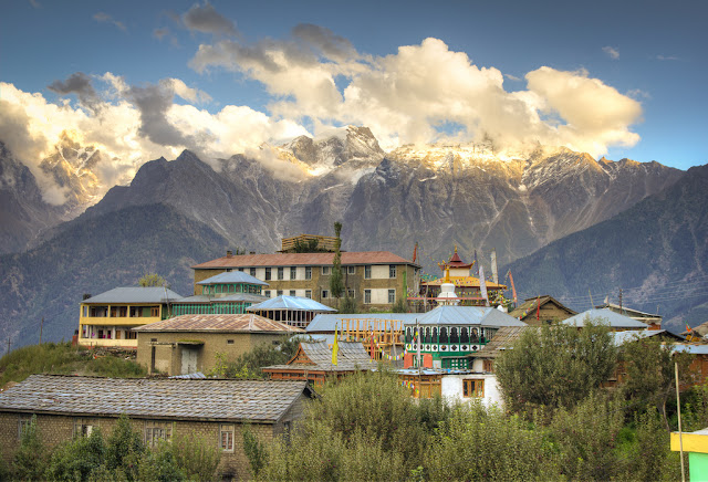
Kalpa : Kalpa is one of the biggest and beautiful villages of Kinnaur. Kalpa is a mountainous area, ranging in altitude from 2,320 to 6,816 metres (7,612 to 22,362 ft), Kinnaur is one of the smallest districts in India by population. It is famous for the Kinnaur Kailash, a mountain sacred to Hindus, close to the Tibetan border. It is a small town in the Sutlej river valley, above Recong Peo in the Kinnaur district of Himachal Pradesh, Northern India, in the Indian Himalaya. Inhabited by Kinnauri people and famous for its apple orchards.
Recong Peo : (2670M) : Located 240 km from Shimla, 7 km from Powari and 13 km from Kalpa. Recong Peo is the headquarter of district Kinnaur.
Rakchham : ( 2,900 metres ) Its name has been derived from 'Rak' a stone and 'Chham' a bridge. The location of the village is striking. It is located on the right bank of the Baspa river.
Kothi : Just 3 km from Recong Peo. Kothi has a temple dedicated to the goddess Chanadika Devi. Set against a backdrop of mountains and graves of the deodar the temple has an unusual architectural style and fine sculpture. An exquisite gold image of goddess is enshrined in sanctum.
Sangla Valley : Sangla is a city in the Baspa Valley, also referred to as the Sangla valley, in the Kinnaur District of Himachal Pradesh, India, close to the Tibetan border. If a landscape had the powers of casting spells, then the Sangla valley would be a magician extraordinary. Once seen, it is a place that can never be forgotten. Even the rushing waters of the Baspa river, that flow through its 95 km length, seem to absorb some of the magic and slow down to savor its snow-frame beauty. 2 km from Sangla is the fort of Kamru (300 m) its tower like architecture resembles that of the Bhima Kali complex and this was the origin of rulers of Bushehar. Chitkul (3450 m) is the last village of the valley and beyond lies Tibet.
Riba (2745M) : Just 18 km from Powari on NH-22 is famous for its vineyards and local wine 'Angoori' made from grapes.
Jangi : 26 km from Powari, the inner border is located here beyond which foreigners require permit to travel upto Tabo. From this point the famous Kinner Kailash Parikarama Trek starts touching Morang, Thangi and Kunocharang villages and entering Chitkul village in Sangla Valley.
Pooh (2837m) : Lush green fields, orchards of apricot, almond trees and vineyards, are to be seen on route to Puh. Just 58 km from Powari along the NH-22, Puh has rest house and basic hotel facilities.
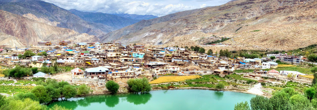
Nako (3662m) : 117 km from Kalpa. In Hangrang Valley is the largest village above sea level. It is also famous for Nako Lake which has boating facilities in summer and during winter its frozen surface is used for ice skating. Buddhist monastery is located here.
Tabo (3050m) : 163 km from Kalpa and 27 km from Sando the ancient village, Tabo is situated on the left bank of river Spiti. Flanked on either side by hills, it is one of the most important Buddhist monasteries regarded by many as only next to the Tholing Gompa in Tibet. It is also known as the Ajanta of the Himalayas. Tabo is the largest monastic complex of Spiti which has since been declared a protected monument under the Archaeological Survey of India.
Kaza (3600m) : 210 km from Kalpa 47 from Tabo. The headquarters of Spiti sub-district, Kaza is on the bank of river Spiti. In earlier times, it was the capital of Nono, the chief of Spiti. It has a Buddhist Monastery and Hindu Temple.
Key Gompa (4116m) : 7 km from Kaza. The largest monastery in Spiti Valley. Established in the 11th century, it has ancient Buddhist scrolls and paintings. Also houses the largest number of Buddhist monks and nuns.
Kibber (4205 m) : 18 km from Kaza. The highest village in the world which is connected by a motorable road and also the highest village in the world which has its own polling station during elections.
Kunzam Paas (4551m) : 76 km: One of the highest motorable passes. Goddess Kunjum keeps guard over the pass and wards of the evil.
=====================================================================================
Altitude : varies from 2,550 metres to 6,791 meters.
Headquarter : Recong Peo ( altitude 2,760 meters ) - former HQ. was Kalpa ( altitude 2,770 meters )
Location : Kinnaur is situated 77°45' and 79°00'35'' East Longitudes and between 31°55'50'' and 32°05'15'' North Latitudes. Kinnaur shares its Eastern boundary with Tibet. On the South and South Eastern sides, it has Uttar Kashi district of Uttar Pradesh. On the Western side lies the Shimla district and on the North and North-West is situated Lahaul and Spiti.
Access by Air : Nearest airport is Jubbar Hatti ( from Shimla to Kalpa ) 244 km.
Access by Road : Almost each and every part of the state is linked by roads. The Himachal Road Transport Corporation is running its buses covering the whole state. There is huge network of HRTC to cater the needs of the people.
Distances : One can travel in a taxi or jeep on National Highway 22 for the entire journey from Kalka to Kinnaur. Some of the parts of journey can be done by long route buses run by HRTC. Distance from Shimla to Kalpa is 244 km.
=====================================================================================


0 Comments